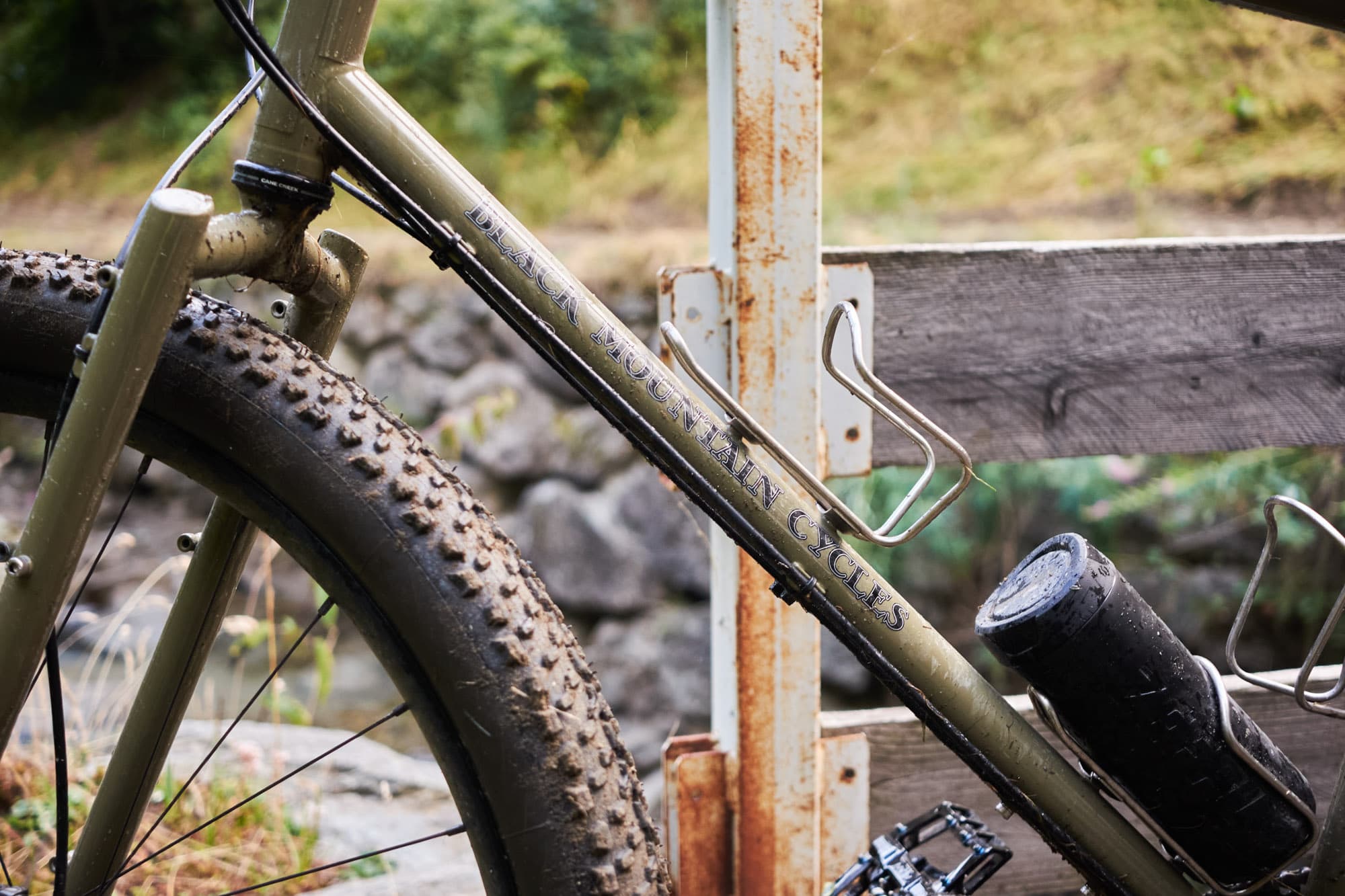
Now that summer is here, I have begun to reminisce about one of the most memorable cycling adventures I ever experienced. Every time I hear the song Acid Rain by Lorn, I’m reminded of my friend Alice and I’s, introspective and somber exploration of British Columbia’s wildly vast backcountry. The South Chilcotins provincial park is 40 km northeast of Lillooet, B.C. The Chilcotin terrain has over 200 km of trails cut through rugged, broad valleys, mid-elevation grasslands, subalpine and alpine meadows, lakes, and mountains. The trails have little to no trail maintenance and limited signage. Those who chose to venture far and deep must be prepared and self-sufficient. Out here, there is no cell service, street lights, or signs. Just dirt roads and the Tyax Lodge.
Having just completed the BC EPIC route in June, my anxious preoccupied tendencies had me thinking about “what’s next?”. Bikepacking the South Chilcotins seemed like the next best thing. The question was, who would join me? The only other person I knew who loved Type 2 fun and had experience mountain biking was my close friend Alice. Luckily it didn’t take much to convince her. Not only is she an outdoor enthusiast, but also a scientist. She is logical, level-headed, and strategic, and would wrestle a bear to protect me. Couldn’t think of a better candidate to tackle the wild country of the Chilcotins.


Self Doubt Sets In
Feeling fresh and excited for the adventure ahead, we loaded up the bikes at the second Tyax Lodge parking lot. For precaution, I checked to confirm the route only to find the Ride With GPS app unresponsive. Despite our mild concern, we managed to find the 140 km loop we wanted on Trailforks and were on our way!
Not long after we began pedaling up Tynaught Lake Road, we crossed paths with a friend and colleague from Squamish, Jake. He asked where we were headed. I chirped, “We’re doing a 140 km loop!” Jake replied, “You two are hardcore. Have fun, and be safe!” Our brief chat with Jake had me wondering if we were in over our heads. Neither of us mentioned our doubts and instead carried on up multiple FSRs. Forest service roads serve two great purposes—elevation gain and direct connectors to trails. There’s no way around them, just up. Once at the trailhead, we were elated by the lush green forest and flowy grassy trail. Jake’s “hardcore” comment was out of sight, out of mind.
With 50 km completed and the sun slowly ducking behind the mountains, we made camp in an open meadow area close to Relay Creek trail. The spot we chose was somewhere we’d leave little to no trace of tent impact, and have an easy source of water. Fear not! There is no shortage of water sources in the South Chilcotins; which means you’ll always have drinking, cooking, and bathing water.


Knee Deep in Mud
We woke up to the sun warming the inside of the tent. Mornings are my favorite part of bike packing. I love the routine of pulling all my cozy items on before leaving the tent and boiling a pot of water for coffee. Delightful!
As usual, packing up our gear and loading it onto the bikes was a process. That morning was no different, except for a surprisingly strong wind swept through the valley. I realized too late that I hadn’t left something in my tent to weigh it down. Sure enough, the wind picked up my tent and launched it up into the air and down the valley. I had never seen anyone barrel through the marsh area barefoot quite like Alice did that morning. The tent stopped flying and landed between a line of trees and a dirt mound and luckily wasn't shredded to bits.
Climbing up Relay Creek trail, the scenery shifted from marshy meadow to beautiful dry pine forest to vast sloping valleys. We came across a known shelter dubbed the Graveyard Cabin. Extremely disappointed by the amount of garbage, scraps of metal, and mistreatment of the cabin; we were reminded to continue to treat this land with the utmost respect as we journeyed on. #LeaveNoTrace

Past the Graveyard Cabin, the trail led us through an open grassland area, and in the distance, a bright rainbow arched over the horizon. In Alice’s Irish ways, she cracked a joke that we’d find gold just on the other side. Ironically, the rainbow’s end would bring us to our first river crossing on the Big Creek Trail. Combined, Big Creek Trail and Big Creek Lorna have 6 water crossings and both held up to their names.
The first was cold, moving fast and above knee and bottom bracket deep but we successfully made it across. Feeling confident, Alice suggested we toss our shoes across the next river. Why not, what could go wrong?! I proceeded to toss my shoes across successfully. On Alice’s turn, however, one of her shoes did a slow roll down the bank and into the rushing water. It was now my turn to run fast barefoot through a forest. Thanks to adrenaline I was able to run alongside the river; watching for the shoe to catch onto something. After a reasonable distance down the river, it finally landed on a sand spit conveniently laying close to a fallen tree. As Alice rolled up her bib shorts and dropped herself into the cold rushing water I truly understood the saying; “the adventure begins when something goes wrong.” If we lost that shoe to the river, it would have made for a very different trip. Alice wrestled her way through the rushing river to the sandpit and came out of the water; legs red and purple. We didn’t toss our shoes across a body of water anymore.


Approaching Big Creek Lorna, the change in elevation and terrain wetland features made for the slowest part of our day. We trudged through thick, sticky, and stinky mud. Slugging through 4 km of the stuff, I cursed Lorna’s name. I am not one to be superstitious or believe in evil spirits, but Lorna showed herself right then. The sky opened up above us and the heavy rain felt like being caught in an Okanagan Valley storm. If the post-rain, knee-deep mud wasn’t tough enough, then came the climbs. Lorna Pass trail, boy oh boy, as we came out of a very steep, alpine-like ridge we began to traverse into a section that I referred to as 'Mars'. The reddish-pink shale rock was slippery and unstable. It was tricky handling the bike while trying to stay on the trail. Those are the moments when you ask yourself “Why am I doing this?” Despite the internal dialogue, I believe, in order to fully understand yourself, you must discover what you are capable of. At the edges is where we find growth.
At 2,213 m in elevation, we finally got to descend. We blasted a technical but incredibly scenic single-track trail carved into the mountainside. Mars to subalpine. Blazing down the Lorna Pass trail and Upper Tyaughton Creek Trail, we reached Manson Creek Camp. Noting that the weather was shifting rapidly, we decided to make camp for the night. Thank goodness we did, because here comes the rain again.
This Changes Everything
That night the temperature dropped incredibly low and all the rainfall had frozen over everything it touched. Pulling all my warm layers on, I gently opened my frozen tent; to a beautiful peachy pink sky highlighting Taseko Peak. Waiting until noon for our gear to defrost; we sat on foam cutouts and sipped on hot beverages. Tip: No matter where you are going, bring a piece of cut-out foam that can be used as a seat (also could be used to reinforce the structure of your handlebar bag).

With our gear packed, we started our day. Our plan was to start on Mid Tyaughton Creek Trail to Deer Pass trail and camp for the night at Spruce Lake. The intersection of Mid Tyaughton Creek Trail and Deer Pass Trail was a bit unwieldy to navigate at first as a nearby creek had washed out a portion of the trail. Carrying the bikes up and over the creekside, we found Deer Pass. Deer Pass trail was equally taxing but offered immeasurable views. Pushing our bikes up 660m for 5.5 km; the landscape changed with each step closer to the peak. Words can’t describe how magnificent the layers of the mountains were. The last 350m was precarious and sketchy. Narrow trail with shale rock and fairly high consequence below. All worth it for the views and descent ahead.
Pausing at 2,324m, we rested and renourished our overworked bodies. Looking around and taking in the views, there wasn’t a tree in sight. Stoked to get back on the bikes for the long alpine descent; from my peripheral, I saw something come over the ridge—a grizzly! There isn’t much anyone can do when in close contact with a grizzly. We chose to be small and wait quietly. It felt like a long time had passed before the bear finally went on its way up the ridge. Feeling both terrified and in awe by its agility; we acknowledged how lucky we were to have seen the grizzly and that it too kept its distance.
The descent was a steep technical single track; and tough to enjoy. My riding had become erratic and desultory. To help shake the crippling fear, we sang at the top of our lungs. With the worst behind us, we reached Mid Gun Grasslands and Hummingbird Lake. The breathtaking turquoise-coloured lake and well-manicured sites were tempting, but with the sun setting we carried onto Spruce Lake Main to ensure a shorter ride for day 4.


Incandescent
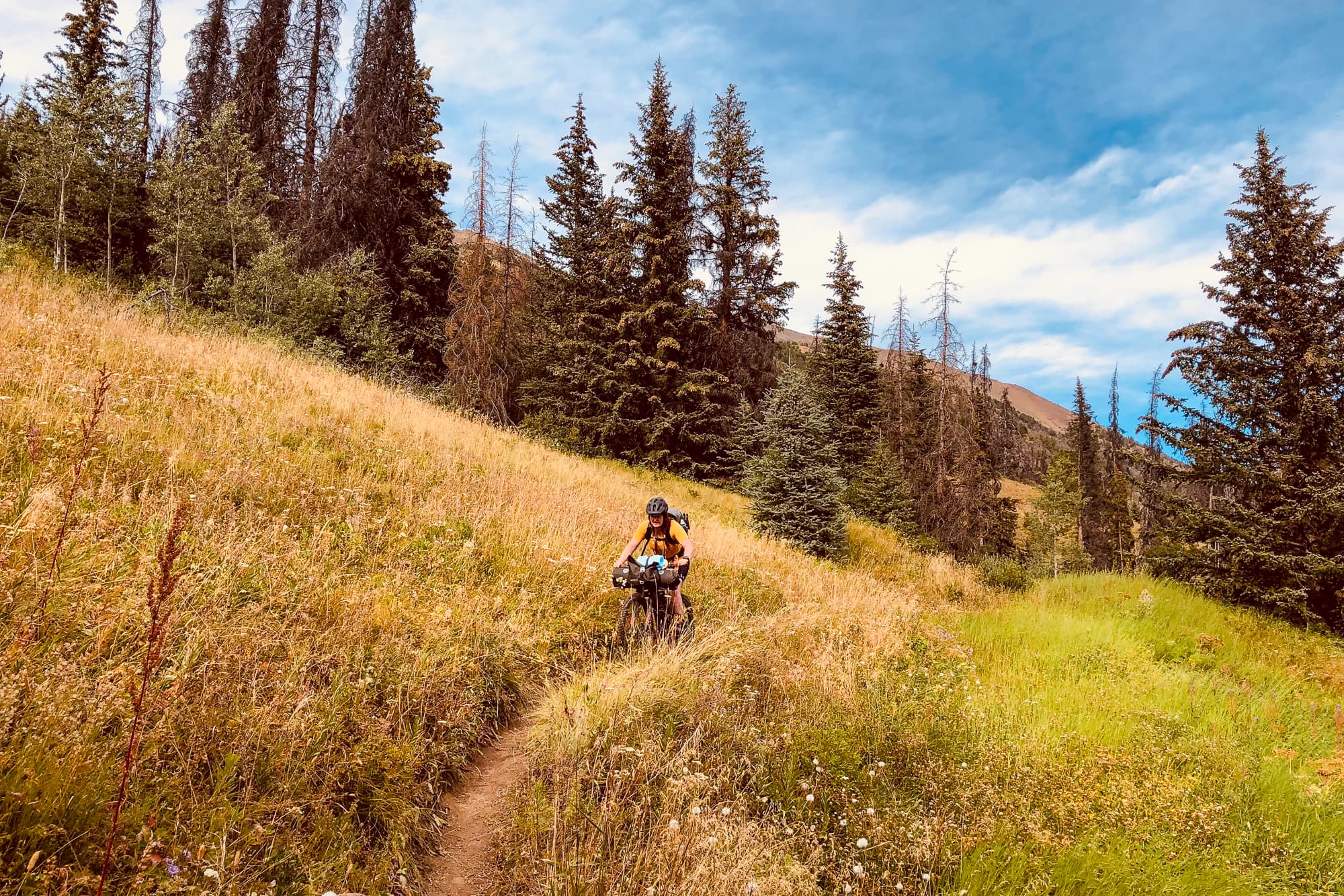
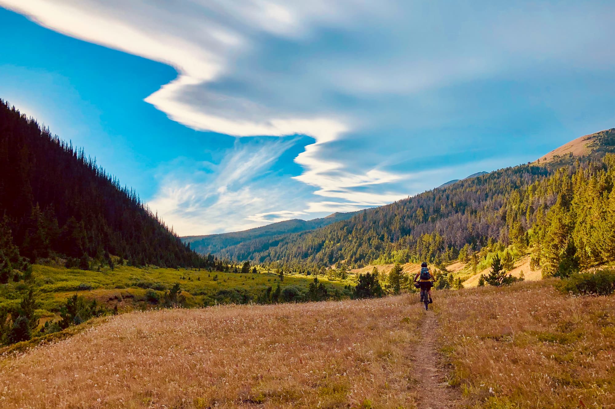
With taxed bodies and damp gear, we crawled out of the tent excited to finish what we started. High Trail would be the last section of our loop. It started pleasantly mild in a rooty dark forest; like many trails we’d experienced so far, had a variety of microclimates. There were sections of tall grass, marshes, steep dry switchbacks, rolling single track, and lots of hike-a-biking. It was a dream!
Reaching the last 15km of the loop, the trail was exposed and full of the Lorax-looking Western Anemone, steep off-camber switchbacks, and meandering cut-through streams. Knowing that our ride was coming to an end, we felt a range of emotions including a strong sense of accomplishment. We discovered a great deal of our personal strengths and weaknesses and that meditation can also be movement. The South Chilcotins are not for the faint of heart. The terrain is both challenging and rewarding. Without a doubt in my mind, I would load up my bike and head back into that wild terrain.